ArcGIS from Basic to Advanced Training
 1K+ Reviews
Instructor-Led Training Parameters
Course Highlights
- Instructor-led Online Training
- Project Based Learning
- Certified & Experienced Trainers
- Course Completion Certificate
- Customized Learning Schedule
- Doubt-Clearing Sessions
ArcGIS from Basic to Advanced Training Course Overview
Advance your GIS expertise with ArcGIS from Basic to Advanced Training by Multisoft Systems. Gain hands-on experience in geospatial analysis, mapping, and visualization using the latest ArcGIS tools. Learn to manage spatial data, perform analysis, and design intelligent maps. Perfect for professionals and students aiming for certification in geographic information systems.
The ArcGIS from Basic to Advanced Training by Multisoft Systems is designed to equip learners with comprehensive knowledge and hands-on expertise in Geographic Information Systems (GIS) using Esri’s ArcGIS platform. This course covers everything from the fundamentals of GIS concepts and spatial data management to advanced topics such as geoprocessing, spatial analysis, cartographic visualization, and 3D mapping. Participants will learn to collect, edit, analyze, and visualize spatial data using ArcMap, ArcGIS Pro, and ArcGIS Online. The training emphasizes practical exercises and real-world scenarios to ensure learners can effectively apply GIS tools in various domains, including urban planning, environmental management, transportation, and resource mapping. Through step-by-step guidance from certified instructors, learners gain the ability to create dynamic maps, automate workflows, and make data-driven decisions using spatial analysis techniques. Whether you are a beginner exploring GIS or a professional looking to deepen your expertise, this course provides a structured pathway to mastering ArcGIS.
Upon successful completion, participants will receive a certificate of training, validating their skills and preparing them for advanced GIS roles in government, research, and private industry sectors. This program bridges the gap between theoretical understanding and practical GIS application for real-world impact.
Instructor-led Training Live Online Classes
Suitable batches for you
| Jul, 2026 | Weekdays | Mon-Fri | Enquire Now |
| Weekend | Sat-Sun | Enquire Now | |
| Aug, 2026 | Weekdays | Mon-Fri | Enquire Now |
| Weekend | Sat-Sun | Enquire Now |
ArcGIS from Basic to Advanced Training Course curriculum
Curriculum Designed by Experts
Advance your GIS expertise with ArcGIS from Basic to Advanced Training by Multisoft Systems. Gain hands-on experience in geospatial analysis, mapping, and visualization using the latest ArcGIS tools. Learn to manage spatial data, perform analysis, and design intelligent maps. Perfect for professionals and students aiming for certification in geographic information systems.
The ArcGIS from Basic to Advanced Training by Multisoft Systems is designed to equip learners with comprehensive knowledge and hands-on expertise in Geographic Information Systems (GIS) using Esri’s ArcGIS platform. This course covers everything from the fundamentals of GIS concepts and spatial data management to advanced topics such as geoprocessing, spatial analysis, cartographic visualization, and 3D mapping. Participants will learn to collect, edit, analyze, and visualize spatial data using ArcMap, ArcGIS Pro, and ArcGIS Online. The training emphasizes practical exercises and real-world scenarios to ensure learners can effectively apply GIS tools in various domains, including urban planning, environmental management, transportation, and resource mapping. Through step-by-step guidance from certified instructors, learners gain the ability to create dynamic maps, automate workflows, and make data-driven decisions using spatial analysis techniques. Whether you are a beginner exploring GIS or a professional looking to deepen your expertise, this course provides a structured pathway to mastering ArcGIS.
Upon successful completion, participants will receive a certificate of training, validating their skills and preparing them for advanced GIS roles in government, research, and private industry sectors. This program bridges the gap between theoretical understanding and practical GIS application for real-world impact.
- Understand the fundamentals and core concepts of Geographic Information Systems (GIS).
- Navigate and use ArcGIS software tools including ArcMap, ArcGIS Pro, and ArcGIS Online.
- Create, manage, and edit spatial and non-spatial data effectively.
- Design professional-quality maps and visual representations of geographic data.
- Perform spatial analysis and geoprocessing for real-world problem-solving.
- Utilize coordinate systems, projections, and data transformation techniques.
- Integrate multiple data sources for advanced mapping and decision-making.
- Automate GIS workflows using ModelBuilder and Python scripting.
- Apply GIS applications in diverse fields such as urban planning, environment, and utilities.
- Develop 3D visualization and analysis using ArcScene and ArcGIS Pro.
- Understand geodatabase design and topology for efficient data management.
Course Prerequisite
- Basic computer literacy and familiarity with Windows operating systems
- Understanding of geography or spatial concepts
- Fundamental knowledge of data management and databases
Course Target Audience
- GIS Analysts and Specialists
- Environmental Scientists and Engineers
- Civil and Structural Engineers
- Data Analysts and Data Scientists
- Infrastructure and Utility Professionals
- Remote Sensing Professionals
- Students pursuing Geography, Environmental Science, or Engineering
- Academicians and Educators in GIS-related fields
- Government and Municipal Planning Officers
- Mining and Natural Resource Professionals
- Professionals transitioning into GIS-based careers
Course Content
- Overview of Geographic Information Systems
- Introduction to the ArcGIS platform and its components
- Setting up a project in ArcGIS Pro
 DOWNLOAD CURRICULUM
- Understanding data types: raster vs. vector
- Importing and managing geospatial data
- Working with attribute tables
DOWNLOAD CURRICULUM
- Creating basic maps and layouts
- Symbolizing and labeling map features
- Configuring basemaps and layers
DOWNLOAD CURRICULUM
- Performing buffer and overlay analysis
- Working with spatial queries
- Conducting network and proximity analysis
DOWNLOAD CURRICULUM
- Introduction to ModelBuilder
- Automating workflows with Python in ArcGIS
- Advanced geoprocessing tools and techniques
DOWNLOAD CURRICULUM
- Creating geodatabases
- Sharing maps and data online using ArcGIS Online
- Publishing services with ArcGIS Server
DOWNLOAD CURRICULUM
- Real-world applications in urban planning, environmental analysis, and business intelligence
- Case studies and project-based learning
DOWNLOAD CURRICULUM

Request for Enquiry
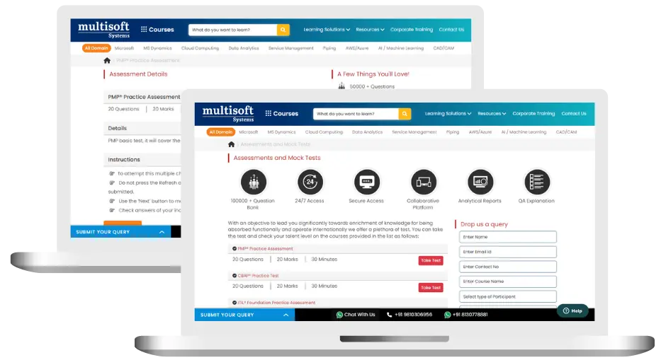
ArcGIS from Basic to Advanced Training (MCQ) Assessment
This assessment tests understanding of course content through MCQ and short answers, analytical thinking, problem-solving abilities, and effective communication of ideas. Some Multisoft Assessment Features :
- User-friendly interface for easy navigation
- Secure login and authentication measures to protect data
- Automated scoring and grading to save time
- Time limits and countdown timers to manage duration.
ArcGIS from Basic to Advanced Corporate Training
Employee training and development programs are essential to the success of businesses worldwide. With our best-in-class corporate trainings you can enhance employee productivity and increase efficiency of your organization. Created by global subject matter experts, we offer highest quality content that are tailored to match your company’s learning goals and budget.
Global Clients


Customized Training
Be it schedule, duration or course material, you can entirely customize the trainings depending on the learning requirements
Expert
Mentors
Be it schedule, duration or course material, you can entirely customize the trainings depending on the learning requirements
360º Learning Solution
Be it schedule, duration or course material, you can entirely customize the trainings depending on the learning requirements
Learning Assessment
Be it schedule, duration or course material, you can entirely customize the trainings depending on the learning requirements
Certification Training Achievements: Recognizing Professional Expertise
Multisoft Systems is the “one-top learning platform” for everyone. Get trained with certified industry experts and receive a globally-recognized training certificate. Some Multisoft Training Certificate Features :
- Globally recognized certificate
- Course ID & Course Name
- Certificate with Date of Issuance
- Name and Digital Signature of the Awardee
ArcGIS from Basic to Advanced Training Trainer Profile
19+ Years Experienced
Our ArcGIS from Basic to Advanced Training Corporate & Certification Program trainers bring 13+ years of proven industry expertise, delivering practical insights aligned with real project environments.
Trained 3950+ Professionals
Our expert trainers have successfully trained 3350+ professionals through structured, real-time training programs designed for industry readiness and career growth.
Certified Experts & Real-Time Project Learning
Build strong practical skills through live project-based training sessions led by certified industry experts with real-world experience.
Hands-on Learning Approach
Gain practical exposure through real-time scenarios, industry case studies, and hands-on assignments that simulate actual project challenges.
Certification Training Guidance
Receive expert support to prepare effectively, practice strategically, and confidently achieve globally recognized certification success.
Customized Training Delivery
Flexible training approach tailored to individual learning goals, skill levels, and evolving industry requirements for maximum effectiveness.
ArcGIS from Basic to Advanced Training FAQ's
ArcGIS is a powerful Geographic Information System (GIS) used for creating, analyzing, and managing spatial data. It helps users visualize geographic patterns, make data-driven decisions, and design interactive maps for industries like urban planning, environment, utilities, and transportation.
What Attendees are Saying
Our clients love working with us! They appreciate our expertise, excellent communication, and exceptional results. Trustworthy partners for business success.
Share Feedback