Civil 3D for Infrastructure Design Professional Certification Prep
 1K+ Reviews
Instructor-Led Training Parameters
Course Highlights
- Instructor-led Online Training
- Project Based Learning
- Certified & Experienced Trainers
- Course Completion Certificate
- Customized Learning Schedule
- Doubt-Clearing Sessions
Civil 3D for Infrastructure Design Professional Certification Prep Course Overview
Learn Civil 3D for Infrastructure Design from global subject matter experts of Multisoft Systems and prepare for the Autodesk Certified Professional: Civil 3D for Infrastructure Design exam. This course covers all aspects of Civil 3D software, from creating surfaces. Earn a globally recognized certificate and take your career in civil engineering design to the next level.
The Civil 3D for Infrastructure Design Professional Certification Prep course is designed to prepare individuals for the Autodesk Certified Professional: Civil 3D for Infrastructure Design exam. The course covers topics such as creating and analyzing surfaces, designing corridors, creating and analyzing pipe networks, and performing grading operations. The course begins with an overview of Civil 3D and its interface, followed by lessons on how to create and analyze surfaces, including surface creation and modification, volume calculations, and surface analysis. The course then covers corridor design, including creating and modifying corridor models, extracting corridor data, and using corridor surfaces. Next, the course delves into pipe network design, covering topics such as pipe network creation and modification, pipe sizing, and pipe network analysis. The course concludes with grading operations, including creating grading groups, modifying grading objects, and analyzing grading objects.
In Multisoft Systems, candidates get one-on-one and corporate training by global subject matter experts of Civil 3D for Infrastructure Design Professional Certification Prep. In Civil 3D for Infrastructure Design Professional Certification Prep, a team of professionals guide candidates to gain hands-on experience through real-world assignments and projects which will help candidates to advance their skills. With an industry-based curriculum, Multisoft Systems delivers project-driven corporate training. Once candidates enroll for themselves for Multisoft Systems’s Civil 3D for Infrastructure Design Professional Certification Prep then will be getting lifetime access to the online learning environment, digital course materials, round-the-clock after-training support, and video recordings, and once the complete the course successfully candidates will earn globally recognized certificate.
- Gain familiarity with the Civil 3D interface and tools.
- Create and analyze surfaces using Civil 3D.
- Understand the principles of corridor design and be able to create and modify corridor models.
- Learn how to extract corridor data and use corridor surfaces.
- Develop skills in creating and analyzing pipe networks in Civil 3D.
- Understand pipe sizing and be able to perform pipe network analysis.
- Learn how to perform grading operations in Civil 3D, including creating grading groups and modifying grading objects.
- Practice using Civil 3D through hands-on exercises and quizzes.
- Prepare for the Autodesk Certified Professional: Civil 3D for Infrastructure Design exam.
- Recorded Videos After Training
- Digital Learning Material
- Course Completion Certificate
- 24x7 After Training Support
- Civil engineers, designers, drafters, and technicians
- Professionals who want to obtain the Autodesk Certified Professional: Civil 3D for
- Infrastructure Design certification
- Individuals who want to enhance their knowledge of Civil 3D and learn best practices
- Students and recent graduates looking to acquire a practical understanding of Civil 3D software
- Anyone interested in learning the latest techniques and tools used for infrastructure design using Civil 3D software.
- Multisoft Systems provides a training certification after successful completion of Civil 3D for Infrastructure Design Professional Certification Prep course.
- Multisoft Systems provides a training certification after successful completion of Civil 3D for Infrastructure Design Professional Certification Prep course.
Instructor-led Training Live Online Classes
Suitable batches for you
| Jul, 2026 | Weekdays | Mon-Fri | Enquire Now |
| Weekend | Sat-Sun | Enquire Now | |
| Aug, 2026 | Weekdays | Mon-Fri | Enquire Now |
| Weekend | Sat-Sun | Enquire Now |
Civil 3D for Infrastructure Design Professional Certification Prep Course Content
Points, parcels, and surveying, Part 1
- Module overview
- Introduction to points
- Create COGO Points
- Specify point parameters
- Assign point styles and point label styles
- Create description key sets
- Rotate point markers and labels
- Create and assign point styles
- Create and assign point label styles
- Edit point properties
- Create point groups
- Change point group display order
- Introduction to the surveying tools
- Work with linework code sets
- Set up a survey database
- Work with the survey figure prefix database
Points, parcels, and surveying, Part 2
- Module overview
- Work with the Traverse Editor
- Perform a mapcheck analysis
- Introduction to parcel creation
- Create parcels by layout
- Create parcels from objects
- Subdivide existing parcels
- Associate parcels with sites
- Work with parcels
- Label parcels
- Create parcel tables
- Renumber and rename parcels
- Create and modify parcel styles
- Create and modify parcel label styles
- Delete parcels
- Practice exercise
Surfaces and grading, Part 1
- Module overview
- Introduction to surfaces
- Define surfaces with data categories
- Control the display of a surface
- Define surface boundary types
- Access and review surface statistics
- Create a TIN surface
- Edit a TIN surface
- Edit the properties of a surface definition
- Create a TIN volume surface
- Create surface labels
- Add contour labels
Surfaces and grading, Part 2
- Module overview
- Use surface analysis
- Set analysis parameters for surfaces
- Perform a surface analysis
- Create feature lines
- Edit horizontal data for feature lines
- Edit elevations for feature lines
- Work with objects on same site
- Create and modify sites
- Create grading groups
- Create grading with grading creating tools
- Work with grading criteria
- Practice exercise
Alignments and profiles, Part 1
- Module overview
- Introduction to alignments
- Create alignments with and without curves
- Add curves, lines, and spirals to an alignment
- Create alignments from objects
- Create an alignment from a pipe network
- Create offset alignments
- Create widenings for an alignment
- Create a surface profile
- Create a profile view
- Compare components of a profile view
- Identify object types in a profile view
Alignments and profiles, Part 2
- Module overview
- Create a profile with the Quick Profile tool
- Split a profile view
- Create and modify a profile
- Edit layout profiles
- Work in the profile grid view
- Add a vertical curve to a profile
- Grip edit a profile
- Add labels to profile views and alignments
- Add station offset labels to alignments
- Create tag labels for alignments
- Add label sets to alignments and profiles
- Add and edit alignment tables
- Practice exercise
- Challenge exercise
Corridors and sections
- Module overview
- Create basic assemblies
- Create a corridor
- Rebuild a corridor
- Create a multiple baseline corridor
- Set targets for corridors
- Remove corridor bowties
- Create objects from a corridor
- Create sample lines
- Edit sample lines
- Create section views
- Create section sheets
- Compute materials
- Practice exercise
- Challenge exercise
Pipe and pressure networks
- Module overview
- Review the part catalog and parts list
- Set the part catalog location
- Add and modify parts
- Create a pipe network
- Edit a pipe network
- Place a pipe network in a profile
- Annotate plan and profile pipe networks
- Modify the pipe network flow direction
- Review the pressure parts catalog
- Create a pressure network parts list
- Create and edit a pressure network
- Place a pressure pipe network in a profile
- Annotate plan and profile of the pressure pipe network
- Practice exercise
Plan production and data management
- Module overview
- Create view frames
- Create a sheet from a view frame group
- Use data shortcuts and external references
- Manage data shortcuts
- Create a data reference
- Practice exercise

Request for Enquiry
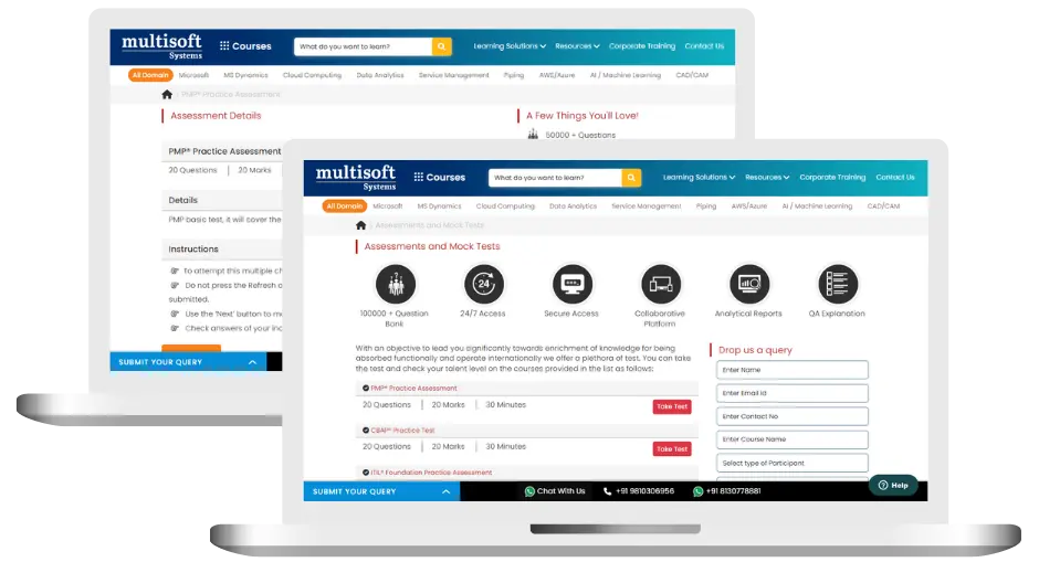
Civil 3D for Infrastructure Design Professional Training (MCQ) Assessment
This assessment tests understanding of course content through MCQ and short answers, analytical thinking, problem-solving abilities, and effective communication of ideas. Some Multisoft Assessment Features :
- User-friendly interface for easy navigation
- Secure login and authentication measures to protect data
- Automated scoring and grading to save time
- Time limits and countdown timers to manage duration.
Civil 3D for Infrastructure Design Professional Corporate Training
Employee training and development programs are essential to the success of businesses worldwide. With our best-in-class corporate trainings you can enhance employee productivity and increase efficiency of your organization. Created by global subject matter experts, we offer highest quality content that are tailored to match your company’s learning goals and budget.
Global Clients


Customized Training
Be it schedule, duration or course material, you can entirely customize the trainings depending on the learning requirements
Expert
Mentors
Be it schedule, duration or course material, you can entirely customize the trainings depending on the learning requirements
360º Learning Solution
Be it schedule, duration or course material, you can entirely customize the trainings depending on the learning requirements
Learning Assessment
Be it schedule, duration or course material, you can entirely customize the trainings depending on the learning requirements
Certification Training Achievements: Recognizing Professional Expertise
Multisoft Systems is the “one-top learning platform” for everyone. Get trained with certified industry experts and receive a globally-recognized training certificate. Some Multisoft Training Certificate Features :
- Globally recognized certificate
- Course ID & Course Name
- Certificate with Date of Issuance
- Name and Digital Signature of the Awardee
Civil 3D for Infrastructure Design Professional Certification Prep Trainer Profile
11+ Years Experienced
Our Civil 3D for Infrastructure Design Professional Corporate & Certification Program trainers bring 13+ years of proven industry expertise, delivering practical insights aligned with real project environments.
Trained 3299+ Professionals
Our expert trainers have successfully trained 3350+ professionals through structured, real-time training programs designed for industry readiness and career growth.
Certified Experts & Real-Time Project Learning
Build strong practical skills through live project-based training sessions led by certified industry experts with real-world experience.
Hands-on Learning Approach
Gain practical exposure through real-time scenarios, industry case studies, and hands-on assignments that simulate actual project challenges.
Certification Training Guidance
Receive expert support to prepare effectively, practice strategically, and confidently achieve globally recognized certification success.
Customized Training Delivery
Flexible training approach tailored to individual learning goals, skill levels, and evolving industry requirements for maximum effectiveness.
Civil 3D for Infrastructure Design Professional Certification Prep FAQ's
To enroll in the Civil 3D for Infrastructure Design Professional Certification Prep training program, individuals can visit the Autodesk website and search for the course. They can then register and pay for the course, after which they will receive access to the course materials and resources.
After completing the Civil 3D for Infrastructure Design Professional Certification Prep course, candidates can take the Autodesk Certified Professional: Civil 3D for Infrastructure Design exam. If they pass the exam, they will receive a digital certificate that can be downloaded from the Autodesk Certification website.
The different modes of learning for the Civil 3D for Infrastructure Design Professional Certification Prep training program include self-paced online learning, one-on-one training with an instructor, classroom-based instruction, project-based learning, and corporate training. Candidates can choose the mode that best fits their learning style and schedule.
Multisoft Systems is committed to offering every Civil 3D for Infrastructure Design Professional Certification Prep course graduate the best post-training assistance available. We provide our candidates with lifetime access to the online learning environment, digital course materials, and round-the-clock support to guarantee their success. Candidates who have registered also have access to video recordings of the training. Participants will receive a certificate that is widely acknowledged upon program completion. If you have any questions or concerns, our staff is always here to help. Do not hesitate to get in touch with us if you need help.
Excellent organizational and individualized training for the Civil 3D for Infrastructure Design Professional Certification Prep course is offered by Multisoft Systems and is instructed by well-known professionals in the field. Their knowledgeable staff provides thorough coaching and support to candidates so they can receive real-world experience through assignments and projects, enabling them to succeed in their careers.
What Attendees are Saying
Our clients love working with us! They appreciate our expertise, excellent communication, and exceptional results. Trustworthy partners for business success.
Share Feedback Download Curriculum